Planning
To be successful any planning application needs to be presented in a manner which shows the development proposal in the context of the current Island Plan.
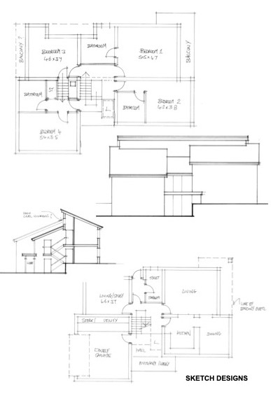
Drawings (indicative list)
Location maps
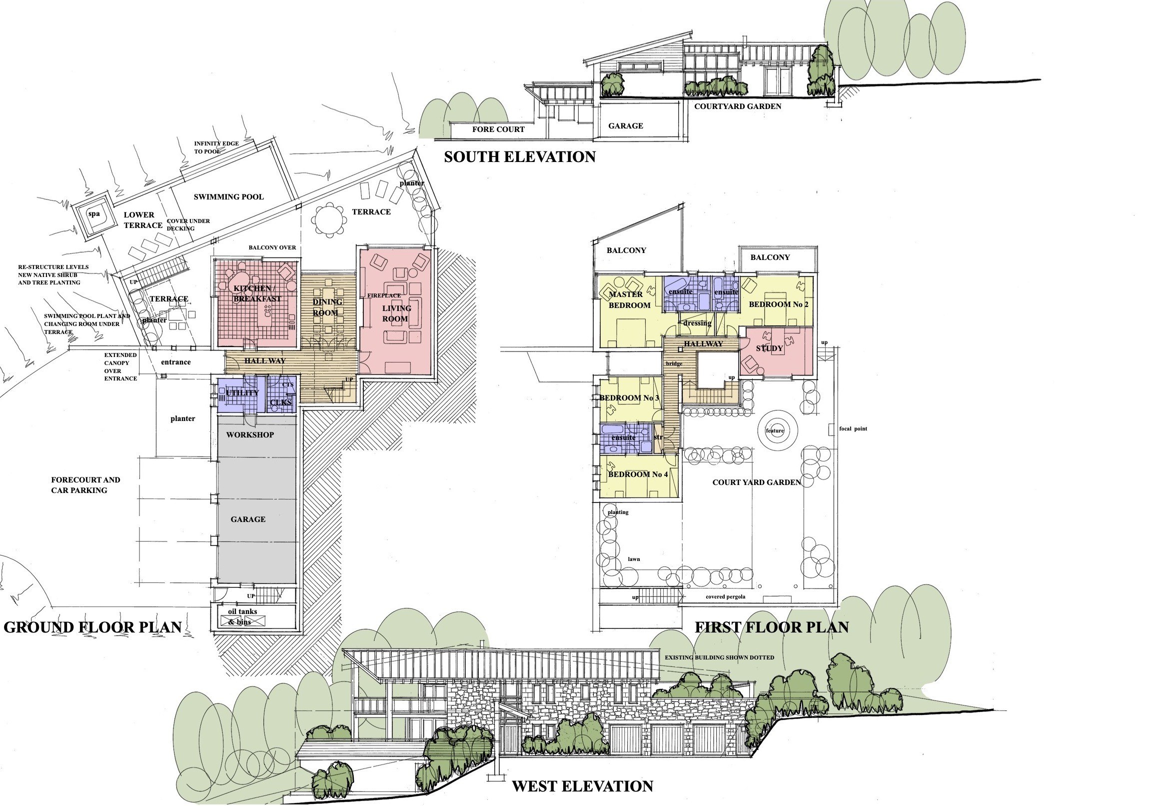
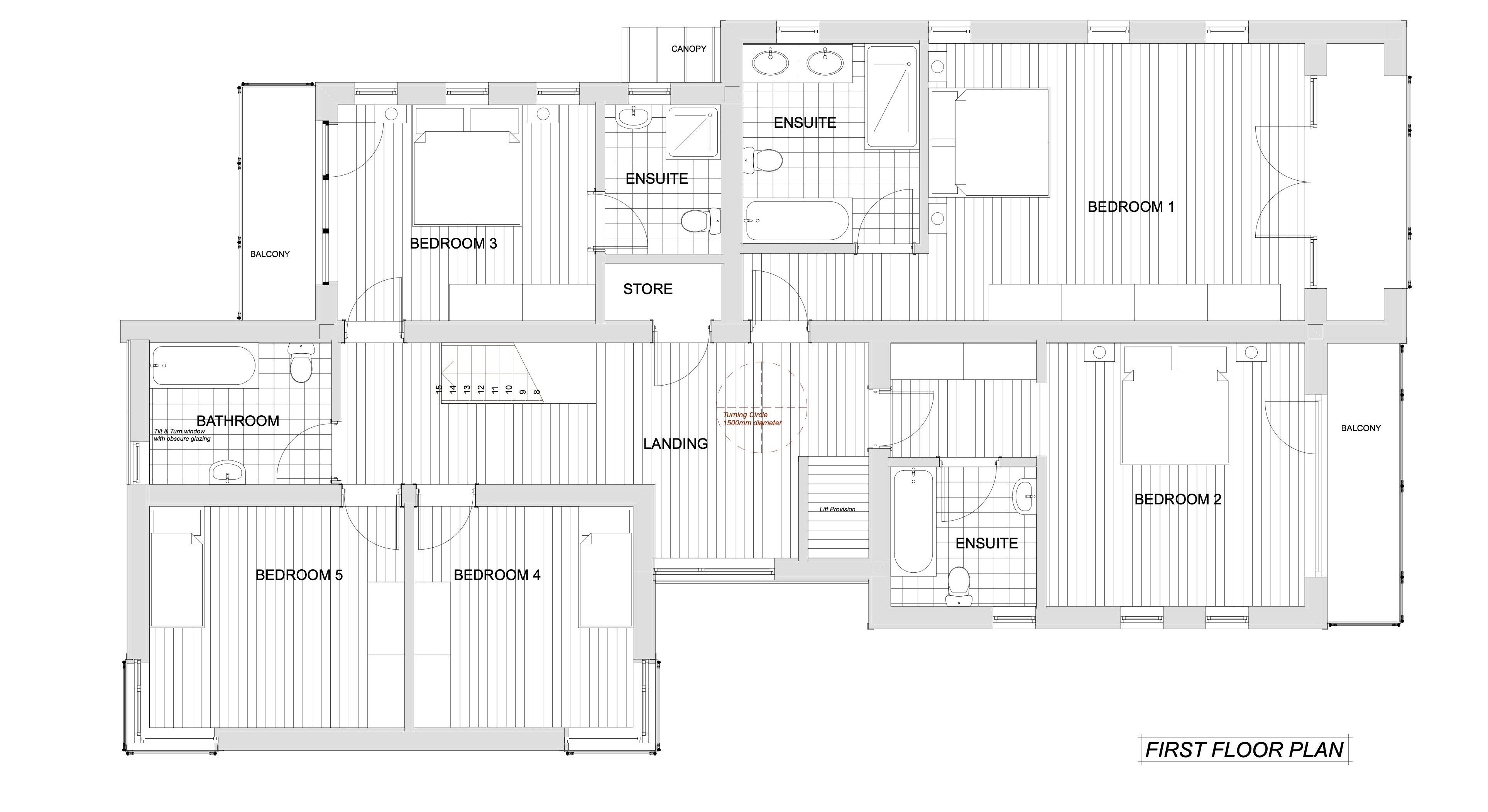
Existing site plan, floor plans, roof plan, sections & elevations
Existing site sections, contextual elevations
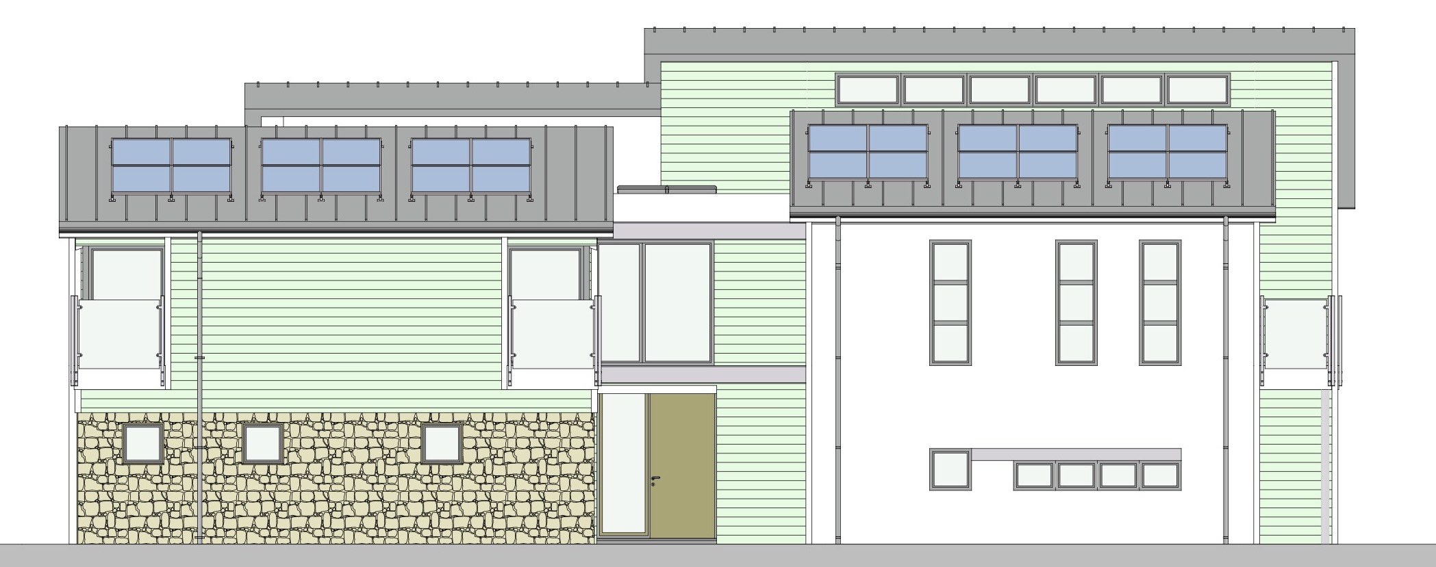
Proposed site plan, floor plans, roof plan, sections & elevations
Proposed site sections, contextual elevations
Vehicle access plans for new entrances & exits
Proposed landscape plan
3d Models
Supporting documentation may include, but is not limited to:
Design Statement
Construction and demolition management plan
Demolition statements
Ecological appraisals / Ecological Impact statements
Drainage assessments and drainage designs
Environmental impact statements
Flood risk assessments
Heritage impact statements
Noise impact statements
Having assessed your project against the relevant Island plan policies, we will advise you of the consultants and services required to fulfil the planning submission requirements. The presentation of your project may include contextual elevations, 3d visuals, 3d white card and physical models.
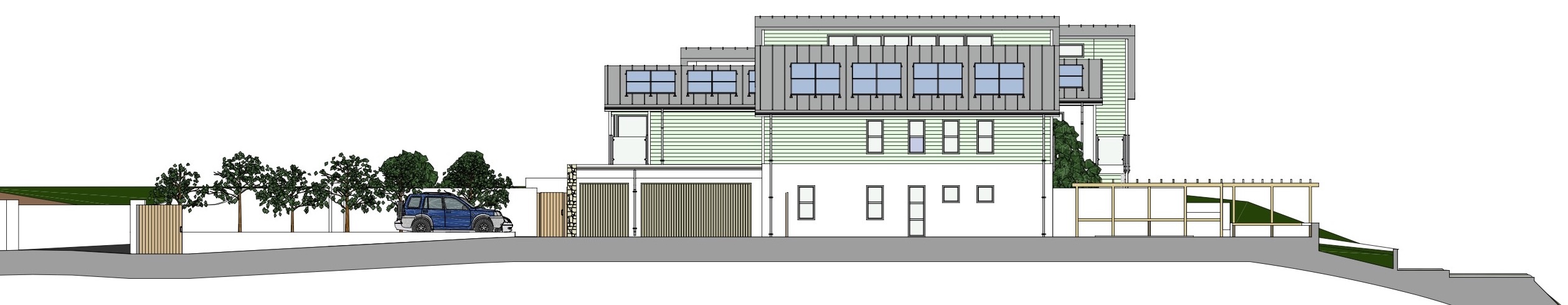
Context Elevation
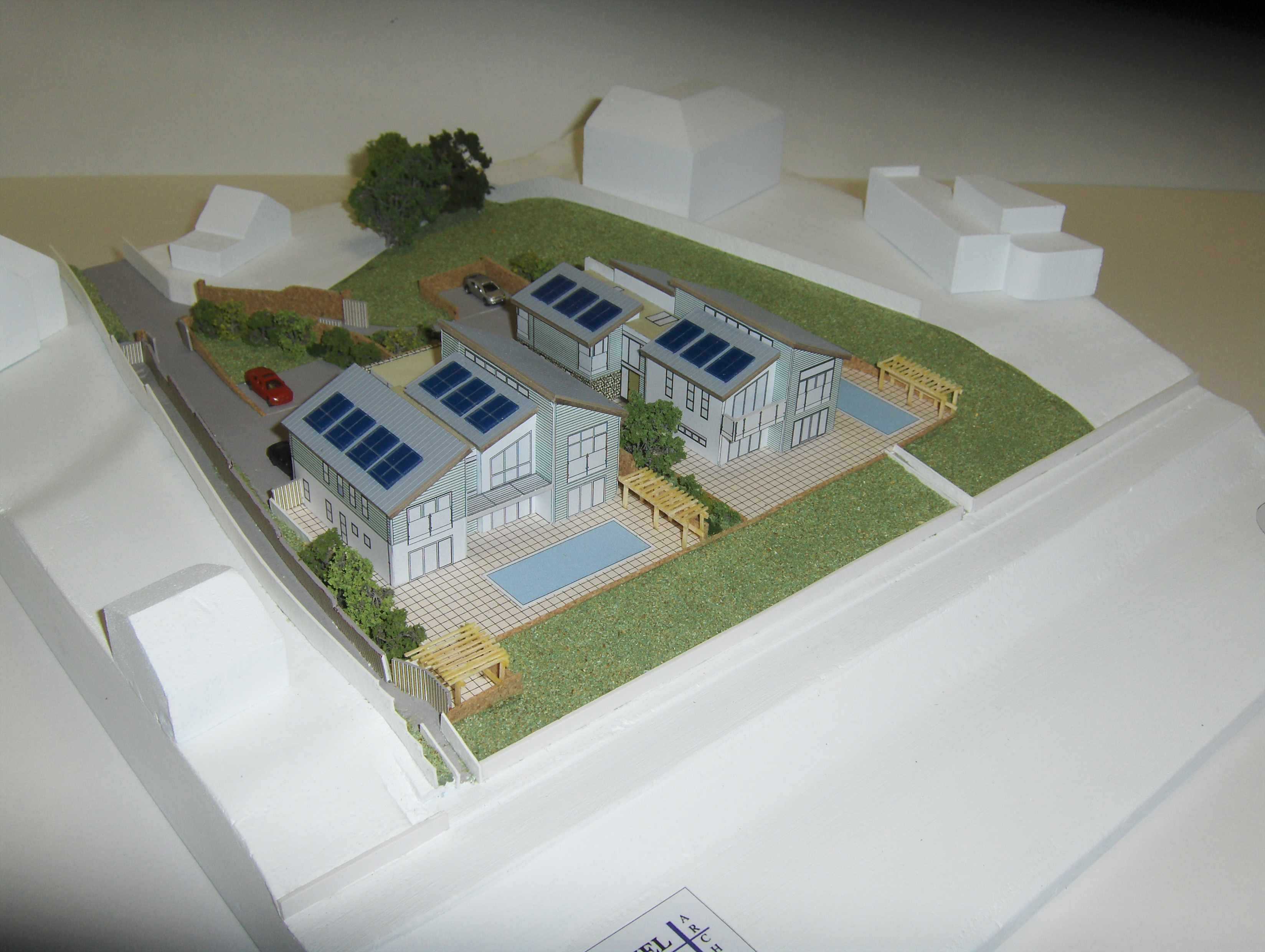
Physical Model
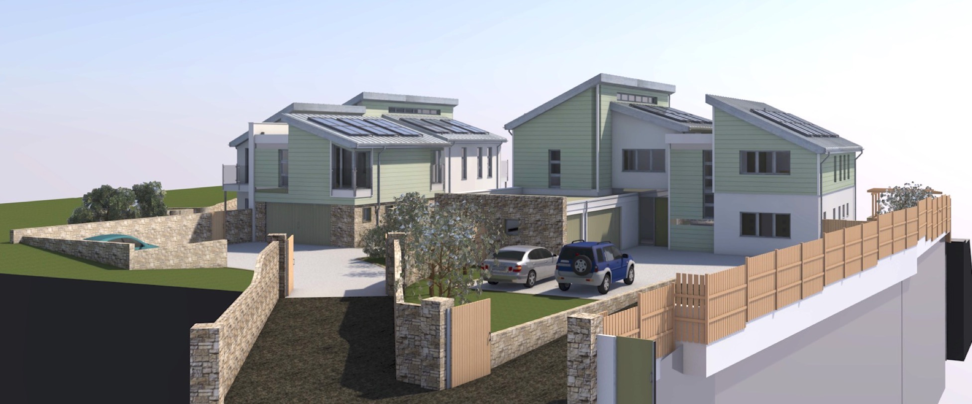
3D Visualisation
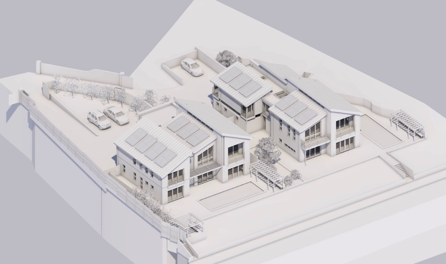
3D White Model
USEFUL LINKS
Do you need planning permission
https://www.gov.je/PlanningBuilding/Permission/Pages/default.aspx
Supplementary planning guidance
https://www.gov.je/PlanningBuilding/LawsRegs/SPG/Pages/default.aspx
Bridging Island Plan
https://www.gov.je/PlanningBuilding/LawsRegs/IslandPlan/Pages/BridgingIslandPlan.aspx
Everything you need to know about Public Planning Meetings
https://www.gov.je/PlanningBuilding/PublicPlanningMeetings/Pages/index.aspx
If you want to see what others are doing you can register for planning alerts here
https://www.gov.je/citizen/Planning/Pages/Notifications.aspx
We are often asked why we must produce so many drawings and documents
Every planning application is subjected to a validation check